Elements of Weather
Weather elements, significance and instruments to measure them


Weather is the ever-changing conditions of the atmosphere with respect to space and time. The weather of a particular area can be defined using weather elements. Weather elements are the bases of the weather. Every meteorologist has their own set of elements, but there are 8 weather elements that in totality determine the weather or climate of a place.
These weather elements are temperature, humidity, wind speed, precipitation, visibility and atmospheric pressure, clouds, and sunshine hours/duration.
Temperature is the measure of how hot or cold our surrounding air feels. Every human being has felt the sensation of temperature. It is the measure of how hot or cold our surroundings feel. Every day, we experience different temperatures, from the cold in winter to the hot weather in summer.
Technically, there are three types of temperature: temperature readings, absolute temperatures, and relative temperatures. Temperature readings are the values on a thermometer. Absolute temperatures are measures of energy. Relative temperature is the comparison of two or more objects to a fixed point in space.
Meteorologists record temperature readings of the atmosphere using instruments like the Stevenson Screen, which consists of thermometers (maximum/minimum), hygrometer/psychrometer (for humidity), barometer
(atmospheric pressure) located 1 meter above ground and provides temperature values in degrees Celcius or Fahrenheit.
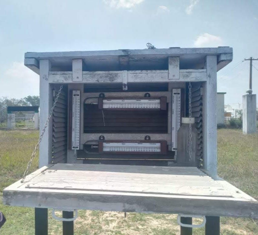
Stevenson Screen (Photo by Poulomi Chakravarty)
Humidity is the measure of the amount of water vapor present in the air. It is usually expressed as a percentage and is an indication of the likelihood of precipitation, clouds and fog. A relative humidity chart is a graph that shows the percentage of humidity at certain temperatures, or the range of values.
A temperature-humidity index is an index that defines the percent of relative humidity per degree change in temperature. A low index number indicates a dry climate while a high index number indicates more moisture. Hygrometer and psychrometer are instruments used to record the humidity of the atmosphere or soil.

Automated Weather Station*(Photo by Poulomi Chakravarty)*
Wind is the measure of the movement of air in the horizontal direction on the surface of the Earth. Wind is a natural phenomenon arising from the uneven heating of the Earth's surface. As the air nears land and cools, it sinks and is replaced by warmer air that rises from the land. This movement of air creates currents or patterns of motion that can be seen in a line going from higher to lower pressure. Wind speed is measured by an anemometer and wind direction is measured by a wind vane.
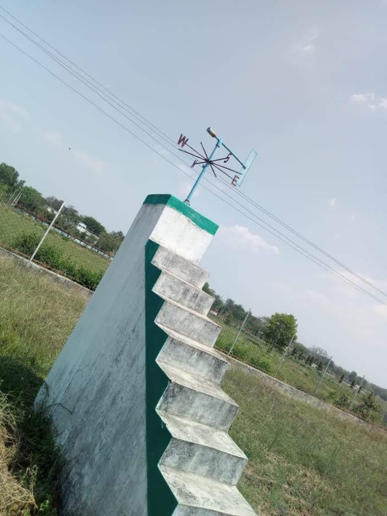
Wind Vane (Photo by Poulomi Chakravarty)
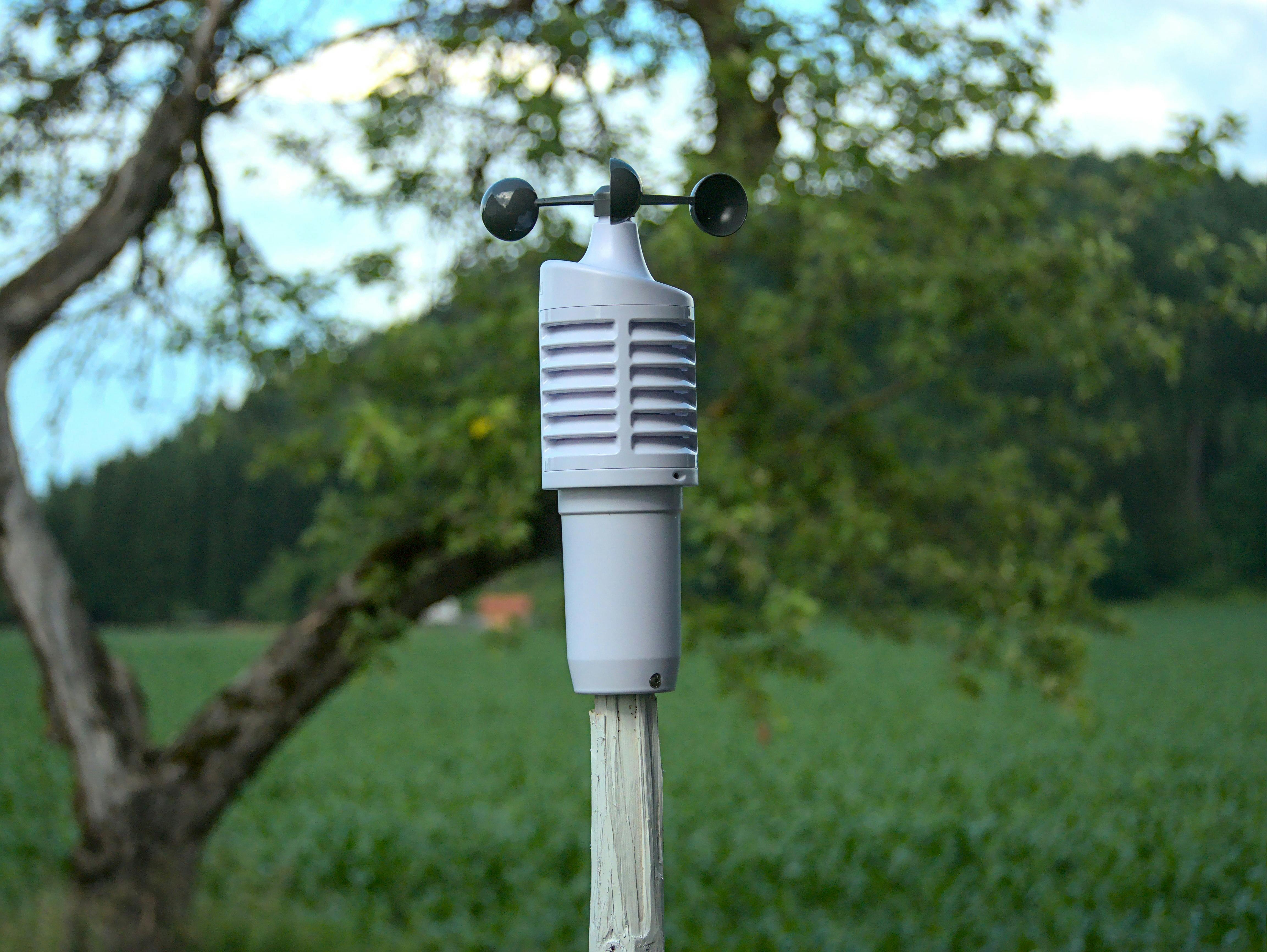
Anemometer (Photo by Benjamin Sadjak onUnsplash)
Precipitation refers to any form of water that falls from the sky such as rain or snow. Precipitation is the process of water droplets condensing from gas and falling to the ground. Precipitation can be majorly classified into rain, snow, and hail Rain is precipitation that falls from clouds in liquid form. It is usually caused by warm air rising and cooling to its dew point or by cold air moving over warmer water. Snow is precipitation that falls from clouds in solid form. Formed due to cold air moving over warmer ground or warm air moving over the colder ground. Hail is precipitation that falls from clouds in solid form, caused by strong updrafts within thunderstorms or when a storm's updraft collides with an outflow boundary of a thunderstorm cell. Precipitation is measured by using Rain-gauge.
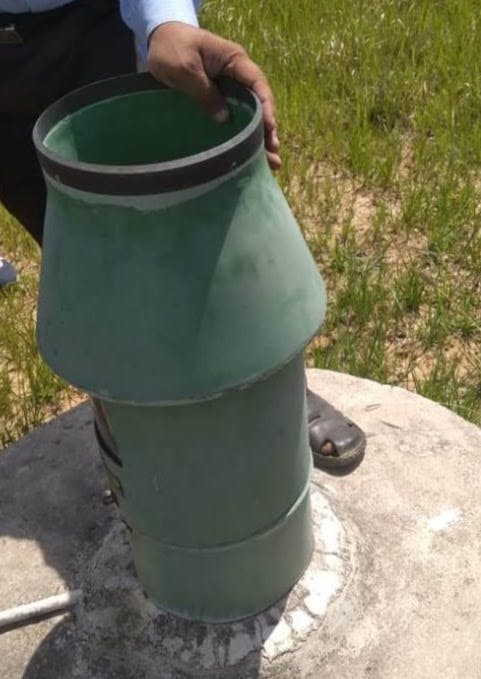
Rain gauge*(Photo by Poulomi Chakravarty)*
Visibility refers to how far one can see. Visibility is also occasionally used by meteorologists as an element of weather. Although it might seem like an unlikely addition to the elements of weather, its significance is relevant in cases like smog, fog, mist, sleet, haze and drizzle. Visibility is important for the safety of travelers on land, sea and air.
There are two types of visibility: near-vision and far-vision. Near-vision is what can be seen in normal daylight, whereas far-vision is seen in low light and darkness. The visibility can range from the point of view of the person using it, or at some point along a route. Visibility (height) may only apply to some objects, such as tall buildings or a hillside.
The height at which visibility decreases may vary depending on factors such as weather conditions, time of day and pollution levels. Special sensors that are capable of scattering light forward can be used to measure visibility these are called Forward scatter sensors. National parks in the United States of America employ nephelometers to measure visibility that follows principles of light scattering.
Atmospheric pressure loosely defined refers to how much air is present above our head. The atmospheric pressure can be measured in millibars or inches of mercury and hectopascals. The higher the atmospheric pressure, the more air there is above us and vice versa. The atmospheric pressure changes with altitude and weather conditions. As we go upwards to higher altitudes, the air is "thinner" which means the weight of air above us is lower.
This is the reason some people have nosebleeds and require oxygen tanks to breathe at very high altitudes. Barometers are measuring devices used to measure atmospheric pressure.
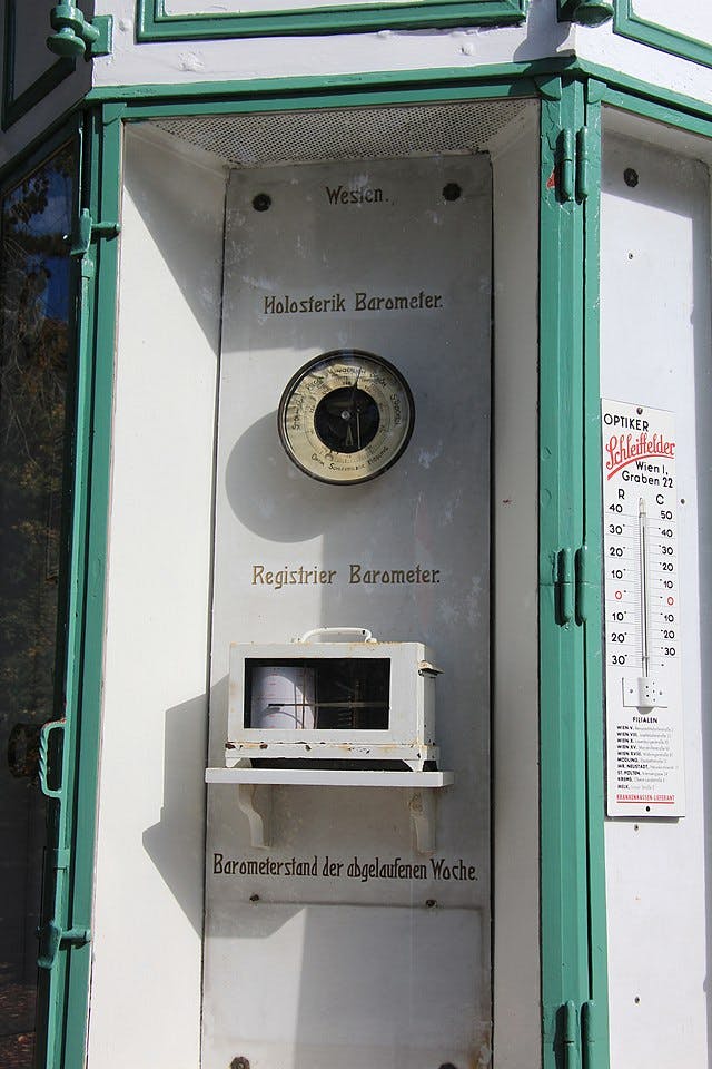
Barometer*(Photo by Karl Gruber on[Wikimedia](commons.wikimedia.org/w/index.php?search=ba..))*
Clouds are the masses of visible droplets of water and crystals of ice present above the surface of the earth. Clouds are a type of atmospheric phenomenon that can be seen in the sky. They are made up of water droplets, ice crystals, or both. Clouds can be classified into three main types: high-level clouds, middle-level clouds, and low-level clouds. High-level clouds are the most common type of cloud and they form at a height of 6 to 20 kilometers above the ground. They are usually made up of ice crystals and they can be seen as cirrus or cirrostratus clouds. Middle-level clouds form at a height between 2 to 6 kilometers above the ground and they are usually made up of water droplets. Low-level clouds form at a height below 2 kilometers above the ground and they are usually made up of water droplets or ice crystals. In terms of meteorology, clouds can be indicators of storms, cyclones and rains.
The measurement of cloud cover is done by satellites that measure how much sunlight is reflected back to space from Earth's surface or by using sensors that measure how much radiation passes through a column of air above an area of land or ocean surface during a certain period (usually one day).
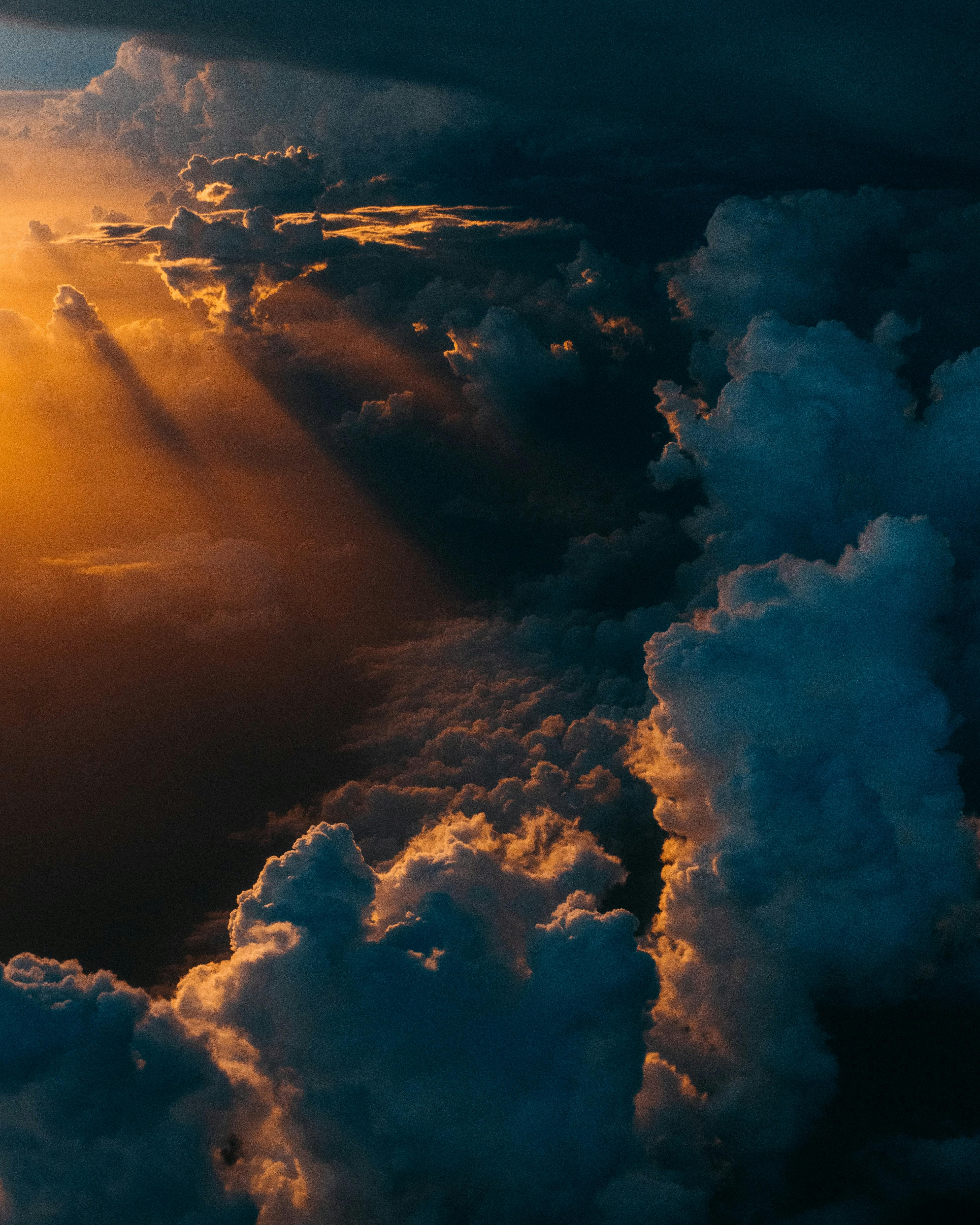
Clouds*(Photo by Tom Barrett on[Unsplash](unsplash.com/photos/hgGplX3PFBg))*
Sunshine hours/duration
The sunshine hour duration is the amount of time that the sun is out in a day. It is usually measured in hours and minutes. The sunshine hour duration varies depending on where you are located on Earth.
The sunshine hour duration can be calculated by multiplying the number of hours in a day by the number of minutes that the sun is out during that day. For example, if there are 12 hours of daylight and there are 30 minutes of sunlight, then there would be 360 minutes or 5 hours and 30 minutes of sunlight for that day.
The duration of sunshine hours has significance in all aspects of our lives because the sun is the main source of energy and all weather phenomena are attributed to the sun's presence.
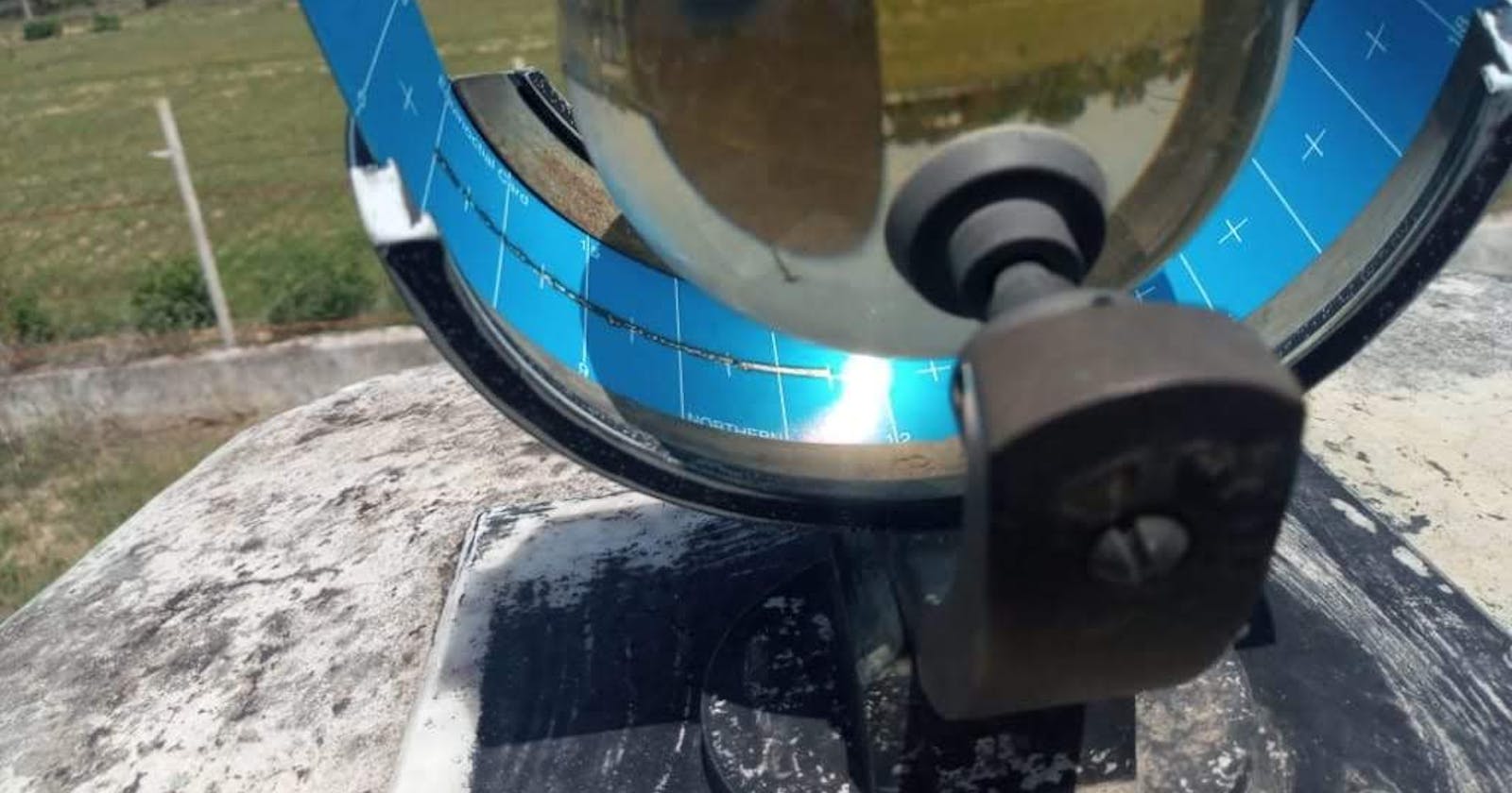
Sunshine hours are calculated using Campbell-Stokes Sunshine Recorder which has a glass sphere that receives the sunlight and burns the strip that has divisions. Meteorologists record the number of divisions burnt by the orb for example 8 divisions and can assume there were 8 hours of sunshine in a day.
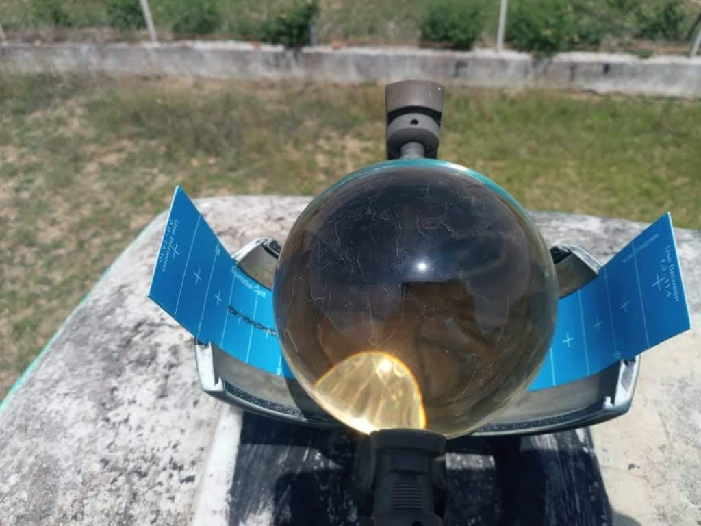
Campbell-Stokes Sunshine Recorder*(Photo by Poulomi Chakravarty)*